Get Outdoors Kansas
Published on Get Outdoors Kansas (https://getoutdoorskansas.org)

Home > Air Cap Memorial Park Trail

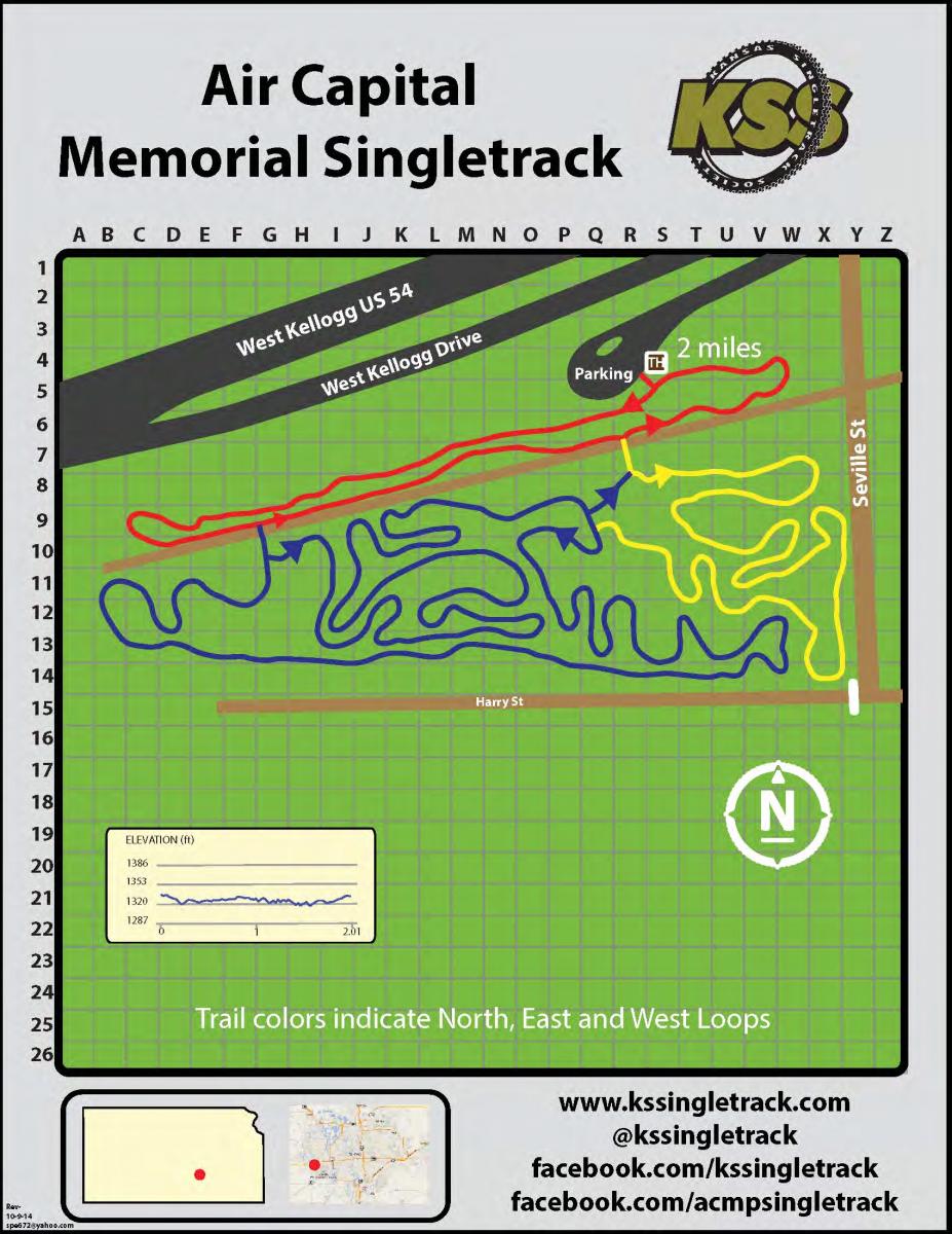
Air Cap Memorial Park Trail [1]

Built in 2012 as a joint project of the Kansas Singletrack Society and the City of Wichita, Air Capital Memorial Park Singletrack Trail provides a suburban venue for off-road bicycle riders and runners. This wooded trail system consists of three connected loops that total a distance of about 2 miles.
But do not let the short distance distract you from this trail's fun factor. It feels longer than it is. There is a beginners North Loop, Intermediate West Loop and the more challenging East Loop. Each loop has twists, turns, and technical features that will challenge and please all riders. Helmets required. Please note that Pawnee Prairie Park, the land south of the park, is closed to bikes and riding there is punishable by law.
The trailhead is located on the west side of Wichita, just southeast of Kellogg/ US 54 and Maize Road at the Kellogg Frontage Road and Seville Street

  • Add A photo

    to this trail
    [2]
  • Add A video

    to this trail
    [3]
  • Download Trail Map

    [4]
  • Tweet [5]
  • [6]

Location:

Latitude:
37.666000366211
Longitude:
-97.454399108887
Click here for directions [7]

Media

  • Trail Photos [8]
  • Trail Videos [9]

This trail has no images associated with it.

This trail has no videos associated with it.

Comments

Sign up to receive emails with ideas for getting active outside and healthy eating on the go!

Email *
  • Contact Us
  • email: info@getoutdoorskansas.org
  • ©2018 Get Outdoors Kansas
  • Privacy Policy

Source URL: https://getoutdoorskansas.org/trails/air-cap-memorial-park-trail

Links
[1] https://getoutdoorskansas.org/trails/air-cap-memorial-park-trail
[2] https://getoutdoorskansas.org/node/add/photo
[3] https://getoutdoorskansas.org/node/add/video
[4] https://getoutdoorskansas.org/sites/default/files/trail_maps/aircap.jpg
[5] https://twitter.com/share
[6] https://getoutdoorskansas.org/print/print/node/7538
[7] https://maps.google.com?daddr=37.666000366211%2C-97.454399108887
[8] https://getoutdoorskansas.org/print/node/7538?qt-trail_node_tabs=0#qt-trail_node_tabs
[9] https://getoutdoorskansas.org/print/node/7538?qt-trail_node_tabs=1#qt-trail_node_tabs